せいしゃ‐ずほう〔‐ヅハフ〕【正射図法】
正射図法
出典: フリー百科事典『ウィキペディア(Wikipedia)』 (2013/11/09 06:51 UTC 版)
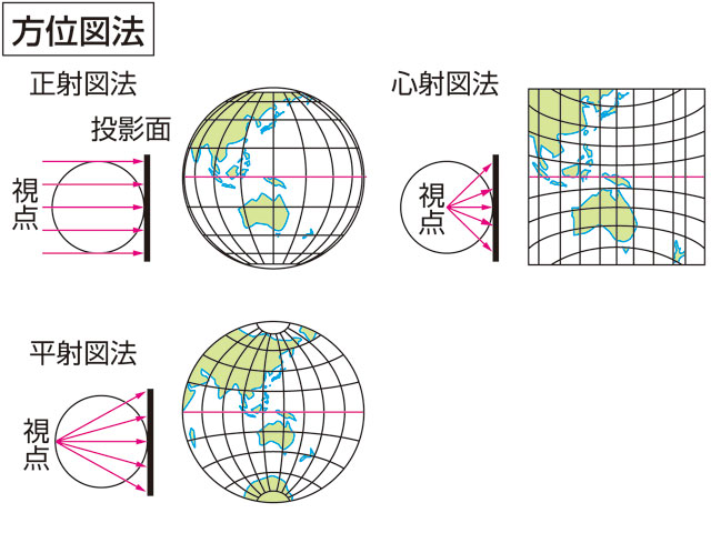
正射図法(せいしゃずほう、orthographic projection)とは地図投影法の一種である。方位図法に分類される。
- ^ Snyder, John P. (1993). Flattening the Earth: Two Thousand Years of Map Projections pp. 16–18. Chicago and London: The University of Chicago Press. ISBN 0-226-76746-9.
[続きの解説]
「正射図法」の続きの解説一覧
- 1 正射図法とは
- 2 正射図法の概要
- 正射図法のページへのリンク