Category:Blue Nile
ナビゲーションに移動
検索に移動
English: The Blue Nile is a river of Africa, one of the two main tributaries of the Nile, the other being the White Nile.
Suomi: Sininen Niili on Afrikassa Etiopian ja Sudanin alueella virtaava joki, joka yhtyy Valkoisen Niilin kanssa Niiliksi.
Italiano: Il Nilo Azzurro è uno dei due rami fluviali, insieme al Nilo Bianco, che danno origine al fiume Nilo.
エチオピアに流れるナイル川の支流   | |||||
| メディアをアップロード | |||||
| 分類 | |||||
|---|---|---|---|---|---|
| 場所 |
| ||||
| 全長 |
| ||||
| 標高 |
| ||||
| 水源 | |||||
| 河口 | |||||
| 分水嶺 | |||||
| 流域国 | |||||
| 支流 |
| ||||
| 関係する湖 | |||||
| 以下と異なる | |||||
 | |||||
下位カテゴリ
このカテゴリに属する 8 個のサブカテゴリのうち、 8 個を表示しています。
- Maps of the Blue Nile (30ファイル)
B
- Blue Nile at Metekel Zone (9ファイル)
C
- Confluence of White and Blue Nile (9ファイル)
G
- Grand Ethiopian Renaissance Dam (18ファイル)
K
カテゴリ「Blue Nile」にあるメディア
このカテゴリに属する 39 個のファイルのうち、 39 個を表示しています。
-
 A boat on the Blue Nile.jpg 3,264 × 1,836;2.28メガバイト
-
 AS07-06-1718.jpg 4,096 × 4,096;3.36メガバイト
-
 AS09-20-3111 (21938320845).jpg 4,400 × 4,600;916キロバイト
-
 Blue Nile, Ethiopia (51625915566).jpg 4,422 × 2,713;9.05メガバイト
-
 Blue Nile, Ethiopia (51625970441).jpg 4,124 × 2,910;9.18メガバイト
-
 Blue Nile, Ethiopia (51625972951).jpg 4,242 × 2,828;11.16メガバイト
-
 Blue Nile, Ethiopia (51625984086).jpg 4,375 × 2,742;9.01メガバイト
-
 Blue Nile, Ethiopia (51626204858).jpg 4,284 × 2,801;9.73メガバイト
-
 Blue Nile, Ethiopia (51626205258).jpg 4,146 × 2,893;13.09メガバイト
-
 Blue Nile, Ethiopia (51626205718).jpg 4,265 × 2,812;13.18メガバイト
-
 Blue Nile, Ethiopia (51626633474).jpg 3,702 × 2,512;9.46メガバイト
-
 Blue Nile, Ethiopia (51626810215).jpg 4,210 × 2,849;11.91メガバイト
-
 Blue Nile, Ethiopia (51626830120).jpg 4,242 × 2,828;12.35メガバイト
-
 Blue Nile, Ethiopia (51626838240).jpg 4,199 × 2,857;9.11メガバイト
-
 Blue Nile, Ethiopia (51626844260).jpg 4,313 × 2,781;12.18メガバイト
-
 Blue Nile, Ethiopia (51626861940).jpg 4,375 × 2,742;10.04メガバイト
-
 Blue Nile.jpg 3,456 × 2,592;5.66メガバイト
-
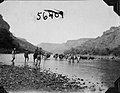 Caravan crossing Blue Nile (3948019009).jpg 1,120 × 865;186キロバイト
-
 Completed new Sebara Dildiy bridge.jpg 3,264 × 2,448;1.07メガバイト
-
 Existující a plánované zavodňovací projekty na Modrém Nilu v Súdánu.png 850 × 600;20キロバイト
-
 From Holata to the Blue Nile at Kutai Ford. (WOMAT-AFR-ABY-17).jpg 2,034 × 7,562;13.33メガバイト
-
 Gibson Monument Stanwell North Relief.jpg 1,280 × 719;594キロバイト
-
 Inbound3775964132098016782.jpg 4,510 × 3,382;5.25メガバイト
-
 ISS-64 Khartoum, Sudan.jpg 3,712 × 5,568;6.82メガバイト
-
 Karte der Länder am Tumat und blauen Flusse.jpg 9,197 × 6,905;11.14メガバイト
-
 Landsat.jpg 5,294 × 5,230;13.13メガバイト
-
 Loving Mother. Baboons, Ethiopia.jpg 724 × 1,086;181キロバイト
-
 Print showing James Grant leaving Karague, Uganda.jpg 2,104 × 1,396;880キロバイト
-
 PZSL1907Page397.png 2,079 × 3,213;7.56メガバイト
-
 Sebara Dildiy Bridge.jpg 1,800 × 1,211;516キロバイト
-
 Sudan agriculture Landsat.jpg 1,200 × 905;220キロバイト
-
 Sudan from sky.jpg 3,264 × 1,836;2.58メガバイト
-
 The Blue Nile in Khartoum.jpg 3,964 × 2,973;5.94メガバイト
-
 The Nile Khartoum Bahri.jpg 1,024 × 768;146キロバイト
-
 Trees on the blue Nile.jpg 3,744 × 5,616;15.71メガバイト
-
 Wad Medani Blue Nile.jpg 1,680 × 1,125;225キロバイト
-
 Whiteandblueniles.jpg 720 × 480;206キロバイト
-
 صورة لوسط جلقني.png 573 × 1,020;892キロバイト
-
 غابة جلقني المحجوزة.jpg 1,080 × 608;257キロバイト


.jpg)
.jpg)
.jpg)
.jpg)
.jpg)
.jpg)
.jpg)
.jpg)
.jpg)
.jpg)
.jpg)
.jpg)
.jpg)
.jpg)

.jpg)


.jpg)