コロラド【Colorado】
コロラド州
出典: フリー百科事典『ウィキペディア(Wikipedia)』 (2023/12/28 05:09 UTC 版)
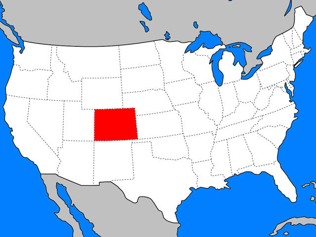
コロラド州(コロラドしゅう、英: State of Colorado [kɒləˈrædoʊ, -ˈrɑːdoʊ] (![]() 音声ファイル))[1]は、アメリカ合衆国西部にある州。北側はワイオミング州に接し、北東はネブラスカ州、東側はカンザス州、南側はニューメキシコ州とオクラホマ州に、西側はユタ州に接している。南西の隅はフォー・コーナーズと呼ばれる4つの州がその角を接するポイントであり、ここでアリゾナ州とも接していることになる。州の南北にはロッキー山脈が貫いており、州全体の平均標高が全米で一番高い、山岳地帯の州である。州の西部はコロラド高原、東の方はグレートプレーンズ(大平原)西部のハイプレーンズである。面積では50州の中で第8位だが、人口では第21位である。
音声ファイル))[1]は、アメリカ合衆国西部にある州。北側はワイオミング州に接し、北東はネブラスカ州、東側はカンザス州、南側はニューメキシコ州とオクラホマ州に、西側はユタ州に接している。南西の隅はフォー・コーナーズと呼ばれる4つの州がその角を接するポイントであり、ここでアリゾナ州とも接していることになる。州の南北にはロッキー山脈が貫いており、州全体の平均標高が全米で一番高い、山岳地帯の州である。州の西部はコロラド高原、東の方はグレートプレーンズ(大平原)西部のハイプレーンズである。面積では50州の中で第8位だが、人口では第21位である。
- ^ “Colorado - Definition”. Merriam-webster.com (2010年8月13日). 2011年6月5日閲覧。
- ^ MLA Language Map Data Center". Modern Language Association.
- ^ "Genocide Wiped Out Native American Population ", Discovery News, September 20, 2010.
- ^ Gehling, Richard (2006年). “The Pike's Peak Gold Rush”. Richard Gehling. 2008年6月28日時点のオリジナルよりアーカイブ。2007年6月12日閲覧。
- ^ “An Act to provide a temporary Government for the Territory of Colorado” (PDF). Thirty-sixth United States Congress (1861年2月28日). 2020年12月23日閲覧。
- ^ Early explorers identified the Gunnison River in Colorado as the headwaters of the Colorado River. The Grand River in Colorado was later tentively identified as the primary headwaters of the river. Finally in 1916, E.C. LaRue, the Chief Hydrologist of the United States Geological Survey, identified the Green River in southwestern Wyoming as the proper headwaters of the actual, overall Colorado River.
- ^ State of Colorado – Division of Information Technologies. “State Names and Nicknames”. 2006年11月15日閲覧。
- ^ Report of the exploring expedition from Santa Fé, New Mexico, to the junction of the Grand and Green Rivers of the great Colorado of the West, in 1859:under the command of Capt. J. N. Macomb, Corps of topographical engineers, Volume 1 @ archive.org
- ^ a b Forty-third United States Congress (1875年3月3日). “An Act to Enable the People of Colorado to Form a Constitution and State Government, and for the Admission of the Said State into the Union on an Equal Footing with the Original States” (PDF). 2008年5月7日時点のオリジナルよりアーカイブ。2008年4月14日閲覧。
- ^ President of the United States of America (1876年8月1日). “Proclamation of the Admission of Colorado to the Union” (php). The American Presidency Project. 2008年4月14日閲覧。
- ^ border
- ^ “Rectangular States and Kinky Borders”. Maa.org (2007年8月30日). 2010年7月30日閲覧。
- ^ U.S. Forest Service. “Rocky Mountain Region 14ers”. 2009年11月6日閲覧。
- ^ "Mount Elbert". NGS data sheet. U.S. National Geodetic Survey. 2011年10月20日閲覧。
- ^ “Elevations and Distances in the United States”. U.S. Geological Survey (2005年4月29日). 2007年10月19日閲覧。
- ^ U.S. Geological Survey. “Elevations and Distances”. 2006年9月8日閲覧。
- ^ a b Doesken, Nolan J.; Roger A. Pielke, Sr., Odilia A.P. Bliss (2003年1月). “Climate of Colorado”. Colorado Climate Center – Department of Atmospheric Science – Colorado State University. 2009年1月25日閲覧。
- ^ "Pikes Peak, Colorado". Peakbagger.com. 2009年10月10日閲覧。
- ^ DRI.edu Western Regional Climate Center. Retrieved October 24, 2006.
- ^ [1] Weather. Retrieved November 11, 2011.
- ^ weatherbase.com
- ^ Slater, Jane (2008年5月28日). “Thursday's Tornado State's 4th Costliest Disaster”. KMGH. 2011年12月30日閲覧。
- ^ “Denver's Consecutive 90 Degree Streaks”. National Weather Service. 2009年10月10日閲覧。
- ^ “A History of Drought” (PDF). 2010年7月30日閲覧。
- ^ “Record Highest Temperatures by State” (PDF). National Climatic Data Center (2004年1月1日). 2007年1月11日閲覧。
- ^ “Record Lowest Temperatures by State” (PDF). National Climatic Data Center (2004年1月1日). 2007年1月11日閲覧。
- ^ http://earthquake.usgs.gov/earthquakes/recenteqsus/Maps/US2/36.38.-106.-104.php
- ^ “Largest Colorado quake since 1973 shakes homes”. USA Today. (2011年8月23日) 2011年8月23日閲覧。
- ^ Resident Population Data. “Resident Population Data - 2010 Census”. 2010.census.gov. 2011年6月5日閲覧。
- ^ a b c d e f g h QuickFacts. U.S. Census Bureau. 2020年.
- ^ “Population growth - Colorado counties”. Epodunk.com. 2011年6月5日閲覧。
- ^ “Population and Population Centers by State – 2000”. United States Census Bureau. 2008年12月4日閲覧。
- ^ “American FactFinder”. 2011年6月13日閲覧。
- ^ “talking about Colorado in "nada"”. Elcastellano.org (2007年6月30日). 2010年7月30日閲覧。
- ^ “National Vital Statistics Reports, Volume 57, Number 12, (3/18/2009)” (PDF). 2010年7月30日閲覧。
- ^ CDPHE.state.co.us, COHID Birth Data Request
- ^ Brittingham, Angela; G. Patricia de la Cruz (2004年6月). “Table 3. Largest Ancestries for the United States, Regions, States, and for Puerto Rico:2000” (PDF). Ancestry:2000;Census 2000 Brief. US Census Bureau. 2008年11月8日閲覧。
- ^ US. “Map of Latitude:39.500656 Longitude:-105.203628, by MapQuest”. Mapquest.com. 2010年7月30日閲覧。
- ^ “U.S. Religion Map and Religious Populations – U.S. Religious Landscape Study – Pew Forum on Religion & Public Life”. Religions.pewforum.org. 2010年7月30日閲覧。
- ^ “The Association of Religion Data Archives |Maps & Reports”. Thearda.com. 2011年6月5日閲覧。
- ^ http://calorielab.com/news/wp-images/post-images/fattest-states-2007-big.gif
- ^ “Fattest States 2010:CalorieLab's Annual Obesity Map - State Obesity Rankings |CalorieLab - Health News & Information Blog”. CalorieLab (2010年6月28日). 2011年6月5日閲覧。
- ^ Knowlton, Andrew. “America's Foodiest Town 2010:Boulder, Colorado:In the Magazine”. bonappetit.com. 2011年6月5日閲覧。
- ^ Arnold, Katie (2008年6月8日). “As Skiers Depart Aspen, Chowhounds Take Their Place”. Aspen (Colo): Travel.nytimes.com 2011年6月5日閲覧。
- ^ “Colorado Travel Guide”. Travelandleisure.com. 2011年6月5日閲覧。
- ^ Jackenthal, Stefani (2008年10月5日). “Biking Colorado’s Wine Country”. Colorado: Travel.nytimes.com 2011年6月5日閲覧。
- ^ “The Jefferson Cup Invitational Wine Competition”. Thejeffersoncup.com (2010年11月24日). 2011年6月5日閲覧。
- ^ “Wine Industry Feature Articles - Is Colorado the New Washington?”. Winesandvines.com. 2011年6月5日閲覧。
- ^ http://www.ttb.gov/appellation/us_by_ava.pdf
- ^ “GDP by State”. Greyhill Advisors. 2011年9月7日閲覧。
- ^ “References” (PDF). 2010年7月30日閲覧。
- ^ “Colorado rides on Fat Tire to beer heights”. Rockymountainnews.com (2007年11月24日). 2011年6月5日閲覧。
- ^ America's Top States for Business 2010." CNBC Special Report (2010):1. Web. 9 May 2011. <http://www.cnbc.com/id/37516043/>.
- ^ Colorado individual income tax return (2005) Revenue.state.co.us. Retrieved September 26, 2006.
- ^ U.S. Individual Income Tax Return (2005) online copy. Retrieved September 26, 2006.
- ^ Bls.gov;Local Area Unemployment Statistics
- ^ http://www.cof.org/files/Documents/Government/StateGiving/CO.pdf
- ^ “EIA State Energy Profiles:Colorado” (2008年6月12日). 2008年6月24日閲覧。
- ^ Colorado Diamonds:Too Little of a Good Thing - JCK-Jewelers Circular Keystone, 1 Jul 1998
- ^ “State of Residence in 2000 by State of Birth”. US Census Bureau. 2009年10月10日閲覧。
- ^ OMB Bulletin No. 20-01, Revised Delineations of Metropolitan Statistical Areas, Micropolitan Statistical Areas, and Combined Statistical Areas, and Guidance on Uses of Delineations of These Areas. Office of Management and Budget. 2020年3月6日.
- ^ Goodman, Josh. “Move Over Missouri, Iowa Is the New Bellwether State”. Governing.com. 2009年10月10日閲覧。
コロラド州
出典: フリー百科事典『ウィキペディア(Wikipedia)』 (2021/04/06 23:27 UTC 版)
「1876年アメリカ合衆国大統領選挙」の記事における「コロラド州」の解説
コロラド州は1876年8月1日に合衆国36番目の州に昇格した。新しい州として大統領選挙戦を組織する十分な時間や金が無く、コロラド州議会が州の選挙人を選んだ。これら選挙人は次々にヘイズと共和党に3票を投じた。
※この「コロラド州」の解説は、「1876年アメリカ合衆国大統領選挙」の解説の一部です。
「コロラド州」を含む「1876年アメリカ合衆国大統領選挙」の記事については、「1876年アメリカ合衆国大統領選挙」の概要を参照ください。
コロラド州
出典: フリー百科事典『ウィキペディア(Wikipedia)』 (2020/05/22 03:55 UTC 版)
「州間高速道路25号線」の記事における「コロラド州」の解説
州内の大きな都市で当路線は、様々なニックネームがつけられている。デンバー市ではバレー・ハイウェイ (Valley Highway)、エルパソ郡ではロナルド・レーガン・ハイウェイ (Ronald Reagan Highway) そしてプエブロ市ではジョン・F・ケネディ・ハイウェイと呼ばれている。 トリニダード市の南23km(14マイル)の地点でコロラド州に入り、コロラド州を480km(300マイル)に及ぶ南北に縦断する主要なルートである。高速道路はシャイアンの南約13km(8マイル)の地点でコロラド州北境を抜ける。デンバー、コロラド・スプリングズ、プエブロ、フォート・コリンズ、およびグリーリーなどのロッキー山脈の東にあるコロラド州のすべての主要な都市を通過する。北から南までのコロラド州のほとんどの場所で、ロッキー山脈がはっきりと見える。 沿線にはバックリー空軍基地、NORADシャイアン山本部、フォート・カーソン、ピーターソン空軍基地、空軍士官学校、およびフランシス・E・ウォレン空軍基地など、重要な軍事施設がある。
※この「コロラド州」の解説は、「州間高速道路25号線」の解説の一部です。
「コロラド州」を含む「州間高速道路25号線」の記事については、「州間高速道路25号線」の概要を参照ください。
コロラド州
出典: フリー百科事典『ウィキペディア(Wikipedia)』 (2021/03/17 22:36 UTC 版)
「コンチネンタル・ディバイド・トレイル」の記事における「コロラド州」の解説
CDTは、コロラド州南部のサンファン山地(英語版)や中央部のサワッチ山脈(英語版)など、コロラド州の標高の高い原生山岳地帯の多くを通過する。ほとんどの地域で、トレイルはよく案内標識が整備されている。約200マイル (320 km) は、コロラド・トレイルと共通となっている。CDT自体は、より高い高度で曲がりくねって約650マイル (1,050 km) 続いている。その年の積雪状況とハイカーの個々のスケジュールに応じて、代替ルートを利用できる。雪が続くなどの天候不良を避けるためのサンファン山脈のクリード・カットオフのルートはその例である。コロラド州の「モンスーン期間」である7月と8月下旬には午後に雷雨が発生するので、積雪期と比較考慮しなければならない。コロラド州のCDTは、州内の14,000フィート(4,300 m)級の多くの山へ立ち寄るルートとなっている。州内のCDTには、明確な案内標識がついたトレイルがない区間があるが、ジョナサン・レイやジム・ウルフが発行している地図が役立つ。コロラド州のCDTの一部は、まだ原野の中のトレイルである。 コロラド州内CDTのその他の注目すべき点は次のとおりである カレッジエイト連山原生自然保護区(英語版) グレイズ・ピーク(英語版) -CDTの最高峰 エルバート山とマッシブ山 -コロラド州の最高峰 ラビット・イヤー峠(英語版) ロッキーマウンテン国立公園 ウルフ・クリーク峠(英語版) ノース・パーク(コロラド盆地)(英語版) ミドル・パーク(コロラド盆地)(英語版) サウス・パーク(パーク郡、コロラド州)(英語版)
※この「コロラド州」の解説は、「コンチネンタル・ディバイド・トレイル」の解説の一部です。
「コロラド州」を含む「コンチネンタル・ディバイド・トレイル」の記事については、「コンチネンタル・ディバイド・トレイル」の概要を参照ください。
「コロラド州」の例文・使い方・用例・文例
- コロラド州のオーロラ市の場所
- 米国の地域で、通常、コロラド州を含む
- 我々は、コロラド州のあたりに山歩に行った
- 米国の南西地域で、通常、ニューメキシコ州、アリゾナ州、テキサス州、ネバダ州、カリフォルニア州と、時にはユタ州、コロラド州を含む
- コロラド州の国立公園で、有史以前に崖に建てられた家がある
- 山、湖、川、森林のあるコロラド州の国立公園
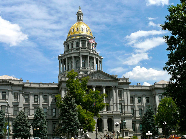
- コロラド州の州都で最大の都市
- コロラドスプリングスの南方のコロラド州の都市
- 南西コロラド州のサンユアン山脈の山頂(標高14,048フィート)
- コロラド州中部にあるロッキー山脈の最高峰(標高14、431フィート)
- コロラド州北部に発する川で、北流してワイオミング州に入り、ついでネブラスカ州で東から南東に方向を変えてサウスプラット川と合流し、プラット川になる
- コロラド州中部にあるロッキー山脈中の峰(14、109フィート)
- 南西コロラド州のサンファン山脈の最高峰(標高14,309フィート)
- ユタ州、コロラド州、ニューメキシコ州のショショーニ族
- 彼女は,昨年9月,米国コロラド州でのトレーニング中に右足首を骨折した。
- 5月までゲストとしてイベントに参加し,その後は,いつも通りコロラド州へ合宿に行く予定だ。
- 今月中旬,高橋選手は米国コロラド州へ合宿に行く。
固有名詞の分類
- コロラド州のページへのリンク

